


NW045 Voting District, St. Louis County, Missouri
About
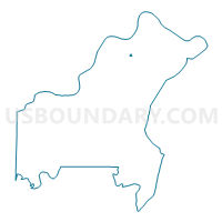
Outline

Summary
| Unique Area Identifier | 610199 |
| Name | NW045 Voting District |
| County | St. Louis County |
| State | Missouri |
| Area (square miles) | 0.08 |
| Land Area (square miles) | 0.08 |
| Water Area (square miles) | 0.00 |
| % of Land Area | 100.00 |
| % of Water Area | 0.00 |
| Latitude of the Internal Point | 38.78187680 |
| Longtitude of the Internal Point | -90.36495950 |
Maps


Graphs
Select a template below for downloading or customizing gragh for NW045 Voting District, St. Louis County, Missouri


Neighbors
Neighoring Voting District (by Name) Neighboring Voting District on the Map
- LC016 Voting District, St. Louis County, MO
- LC038 Voting District, St. Louis County, MO
- NW034 Voting District, St. Louis County, MO
Top 10 Neighboring County Subdivision (by Population) Neighboring County Subdivision on the Map
- Lewis and Clark township, St. Louis County, MO (37,217)
- Northwest township, St. Louis County, MO (32,245)